|
|
|
|
|
|
| |
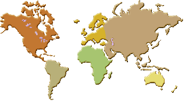
World atlas, maps and globes
An atlas is a collection of maps, traditionally bound as a book but now often published online. Maps reduce the curved surface of the Earth to a flat plane, which requires a map projection. Every projection distorts something — area, shape, distance or direction — so different projections suit different purposes. The Mercator projection preserves local angles and was historically used for navigation, but it greatly exaggerates the size of regions near the poles. A globe avoids this problem by keeping the Earth's true spherical proportions, at the cost of portability and detail.
Maps are usually classified by what they show. A political map emphasises countries, borders, capitals and major cities, while a physical map highlights terrain such as mountains, rivers, deserts and ocean basins. Thematic maps display a single variable, for example population density, climate, vegetation or economic activity. Outline maps show only coastlines and boundaries, leaving the interior blank so that students can label features themselves.
A modern atlas also records reference data that changes over time, including national flags, the names and populations of capital cities, forms of government, and the world's largest urban areas. Closely related is the division of the globe into time zones, each based roughly on lines of longitude and offset from Coordinated Universal Time. Because borders, populations and the status of cities shift, atlas data must be revised periodically to stay accurate.
Frequently asked questions
- Why do all flat maps distort the Earth?
- Because a sphere cannot be flattened without stretching or tearing. Each projection chooses which property — area, shape, distance or direction — to preserve and which to distort.
- What is the difference between a political and a physical map?
- A political map shows human divisions such as countries, borders and cities. A physical map shows natural features such as mountains, rivers and elevation.
- What is an outline map used for?
- An outline map shows only boundaries and coastlines, so learners can fill in countries, capitals or other features as a study or test exercise.
|
|
| Alabama maps
maps, geography, cartography, historical, counties, transportation, education, climate, politics |
|
Antique Maps |
| Astrodienst
atlas database atlas and timezone, find geographic locations, horoscope, BEL: 50n57, 3e48, Belgium, Oosterzele |
|
Bing Virtual Earth |
|
Country
Profiles Find photos, maps, and articles for all the countries of the
world |
| Flash Earth
...satellite and aerial imagery of the Earth in Flash Flash Earth
...satellite and aerial imagery of the Earth in Flash |
| Geographic.org
geography, climate, countries, flags, maps, world population, economy |
| Geographic
names thesaurus a structured vocabulary of geographic names, Lat: 50 57 N Long: 003 48 E (Oosterzele), (represented in degrees
minutes direction) or Lat: 50.950 Long: 3.800 (represented in decimal degress and fractions of degrees) |
|
Geography of Europe Geography of Europe, Geography relief of Europe
maps, clickable mountains and rivers maps, countries, towns and European
Union maps, Europe cities pictures and landscapes images |
| Google maps
maps, satellite view, street level view |
|
Info
nation up to seven countries of the world can be compared : statistically, economically |
|
Infoplease Atlas |
| Interactive
map of Europe Africa,
Asia, United States,
Middle East,
South America,
Canada, Central America |
| Interactive
world maps,
Satellite
images |
| ISLANDS
Web Site Basic environmental and geographic information on the
significant islands of the world |
| Mapblast
(merged with msn) to obtain a
map including the desired address with longitude and latitude |
| MapMachine:
online dynamic atlas |
|
Maps of Europe
Maps of Europe, Europe (Reference Map), Europe Historical Maps |
| Mapquest online map creation on basis of input address |
|
Openstreetmap |
| Perry-Castañeda
library map collection maps of all countries of the world, a general collection of more
than 250000 maps covering all areas of the
world |
| Relief
web map centre reference and thematic maps concerning current and past humanitarian emergencies and
natural disasters, a tip |
| United Nations cartographic section |
| Virtual
Globetrotting |
|
World
atlas and maps maps and geographical information for every country, state, continent, and ocean |
|
World Sites Atlas
World Sites Atlas features maps of world regions, countries, states, and
cities, plus hotels, destination guides, facts, useful links, photos, and
more |
|
World
atlas a collection of world, continent, country, island |
|
Worldmapper
a collection of world maps, where territories are re-sized on each map
according to the subject of interest |
|
|
Home
|
Site Map
|
Email: support[at]karadimov.info
Last updated on:
2026-06-24
|
Copyright © 2011-2021 Educypedia.
https://educypedia.org
|
| |
|
|
| |
|