|
|
|
|
|
|
| |
Outline Maps and World Atlases
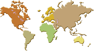
An outline map shows the borders and coastlines of a region without labels, place names or other detail. Blank maps of this kind are widely used in education, because they let students locate and name countries, cities, rivers and other features themselves, reinforcing geographic knowledge through active recall. A world atlas, by contrast, is a collection of detailed maps that present a great deal of information about the Earth's surface and its political divisions.
Political maps focus on the human geography of the world: the boundaries of countries and states, their capital cities and largest cities, and the way territory is divided among governments. They are often paired with reference data such as the area and population of each country, the flags of nations, and the major oceans and seas that separate the continents. Together these resources give an overview of how the world is organised politically.
Maps also represent features that help people understand global patterns. Time zones divide the Earth into regions that keep a common clock time, reflecting the planet's rotation and the position of the sun. Globes show the world in three dimensions, conveying the true shape and relative size of land masses better than a flat map can. Because any flat map distorts the spherical Earth to some degree, comparing maps, globes and reference figures gives a fuller picture of world geography than any single representation alone.
Frequently asked questions
- What is an outline map used for?
- An outline map is a blank map showing only borders and coastlines. It is used in teaching so that learners can label countries, cities and features themselves and test their geographic knowledge.
- What does a political map show?
- A political map shows human-made divisions such as country and state boundaries, capital cities and major cities, rather than physical features like mountains and rivers.
- Why are there time zones?
- Time zones exist because the Earth rotates, so the sun is overhead at different places at different moments. Dividing the world into zones lets each region keep a clock time roughly matching daylight.
|
|
Outline maps  |
|
Africa Blank map
jpg file |
|
Asia Blank Map of
Asia |
|
Blank Map of Europe
Blank Map of Europe, jpg file |
| Blank
outline maps of each country blank outline maps of each country |
|
Blank worldmap png file |
|
Blank worldmap |
| d-maps.com
contains 5258 maps, each one proposed in 6 graphic formats (GIF, PDF, CDR,
SVG, AI, WMF), World and oceans, Africa, America, Asia, Europe,
Mediterranean sea, Oceania, Historical maps |
| Graphic maps
Atlas - Xpeditions, maps made for printing |
|
Graphic maps
FREE maps available in jpeg format |
| Map maker
online map drawing utility, only United States |
|
Mercator projection of the world jpg
file |
|
North
America Blank map Blank map of North America, jpg
file |
|
Online map
creation online map creation |
| Outline maps
Outline maps |
|
Outline map of
the world gif file |
|
Outline map of
the world gif file |
|
Outline map of
the world Colorful Political outline World map,
gif file |
|
Outline map of
the world Small Political outline World map, gif file |
|
Outline map of
the world blank world map |
|
Political World Map Blank Political World Map |
|
Printable World
Map Generator by Freemap |
| World Map
Printable world map, Blank Political World Map, png
file |
|
World Map pdf file |
|
World Map 2 pdf file |
|
|
Home
|
Site Map
|
Email: support[at]karadimov.info
Last updated on:
2026-06-24
|
Copyright © 2011-2021 Educypedia.
https://educypedia.org
|
| |
|
|
| |
|